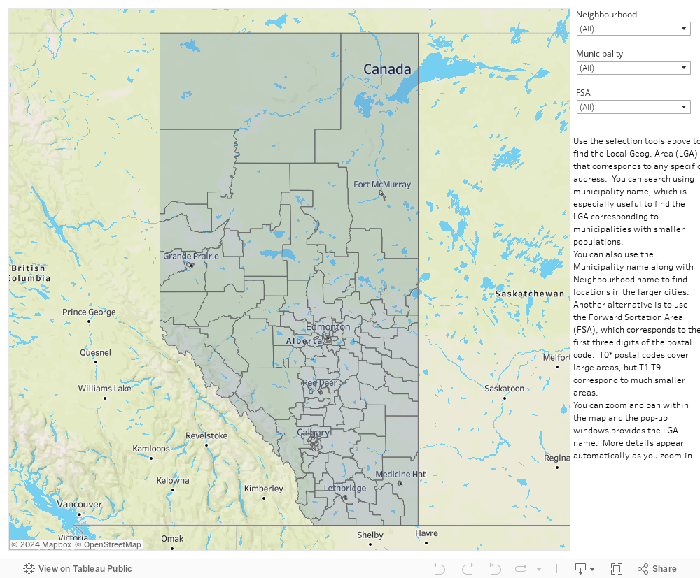
Local Geographic Area Lookups
Local Geographic Areas are geographic boundaries used by Primary and Preventative Health Services and Alberta Health Services to summarize health data and for planning purposes. Local Geographic Areas have been used to organize some of the health information on this website (for example, the socioeconomic and public health information).
Quick Search
The quick search allows you to find a Local Geographic Area by searching municipal names (like "Edmonton") or postal codes. When you search using a municipal name or postal code, all the matching Local Geographic Areas will appear under the “Aggregate Geography” column (updated October 2024.)
Search Municipality or Postal Code
Aggregate Geography
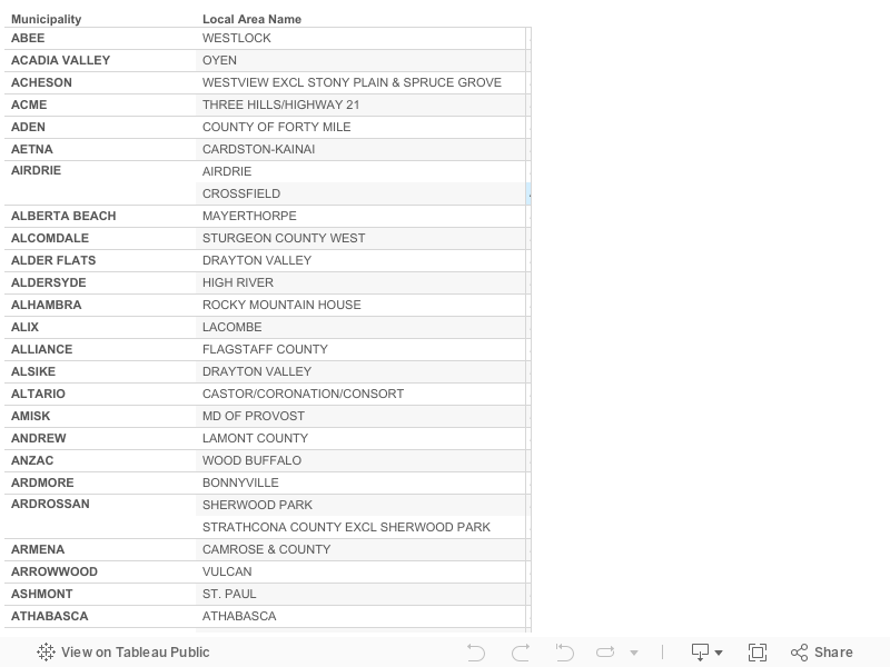
Community Table
The table below provides a list of the Local Geographic Area names for Alberta communities. Some communities are divided into several Local Geographic Areas, so more than one Local Geographic Area will appear beside these communities. A postal code search is also available if you live in an urban centre that has been divided into multiple Local Geographic Areas.
Postal Code Table
This table provides a list of the Local Geographic Area name for every postal code in Alberta. Because the list of postal codes is very long, a community name filter has been set on the right (default is Lethbridge). Select "All" at the top of the list to see the list of all postal codes or the community name assigned by Canada Post.